Reframing Satellite Imagery Access with AstraView
As Earth Observation enters an era of abundant satellite data, AstraView by Dhruva Space acts as the unified access layer for multi-constellation imagery. The platform integrates optical, SAR, and hyperspectral sources into one interface, enabling efficient satellite tasking, archive search, and multi-sensor planning for real-world operations.
Reframing Satellite Imagery Access with AstraView
Earth observation has entered an era of scale. Constellations have shortened revisit cycles, resolutions continue to improve with each new generation of satellites, SAR imaging has become commercially viable at scale, and capabilities such as hyperspectral and RF sensing, once largely experimental, are now operational and widely deployed.
From a hardware perspective, the ecosystem is abundant with data sources. On the ground, however, access remains uneven, often constrained by practical barriers that limit effective use.
Teams working in areas like disaster response, infrastructure monitoring, maritime domain awareness, and border security, rarely depend on a single sensing modality. Operational requirements evolve based on prevailing weather, terrain characteristics, the level of urgency, and the depth of analysis needed. A collection strategy reliant solely on optical imagery is likely to fail during periods of persistent cloud cover or monsoons.
For instance, SAR provides reliable all-weather penetration but frequently lacks the visual context required for full interpretation. In similar vein RF signals can indicate activity or presence but typically demand corroboration from imagery to build complete situational understanding.
The technical capabilities exist across the industry. What is often missing is coherent, streamlined access that supports real-time decision-making.
The Structural Constraint
A primary source of friction in satellite imagery today stems not from insufficient supply but from fragmentation across the ecosystem.
Archive discovery tends to be confined to individual vendor platforms, fresh tasking usually requires separate feasibility validations per provider, weather forecasting remains external to most data acquisition workflows, and native support for multi-sensor planning is still uncommon in current imagery procurement systems.
These factors create operational inefficiencies precisely at the moments when timeliness and reliability are most critical. Organizations typically respond by building layered relationships with several vendors or negotiating dedicated capacity agreements. While these workarounds can be effective, they introduce additional layers of contractual, regulatory, and day-to-day operational complexity.
Against this backdrop, AstraView was conceived as a structural response.
AstraView as the Unified Access Layer
AstraView by Dhruva Space functions as a unified access layer, structuring and orchestrating a distributed imagery ecosystem into a single operational environment.
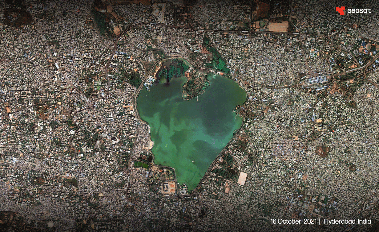
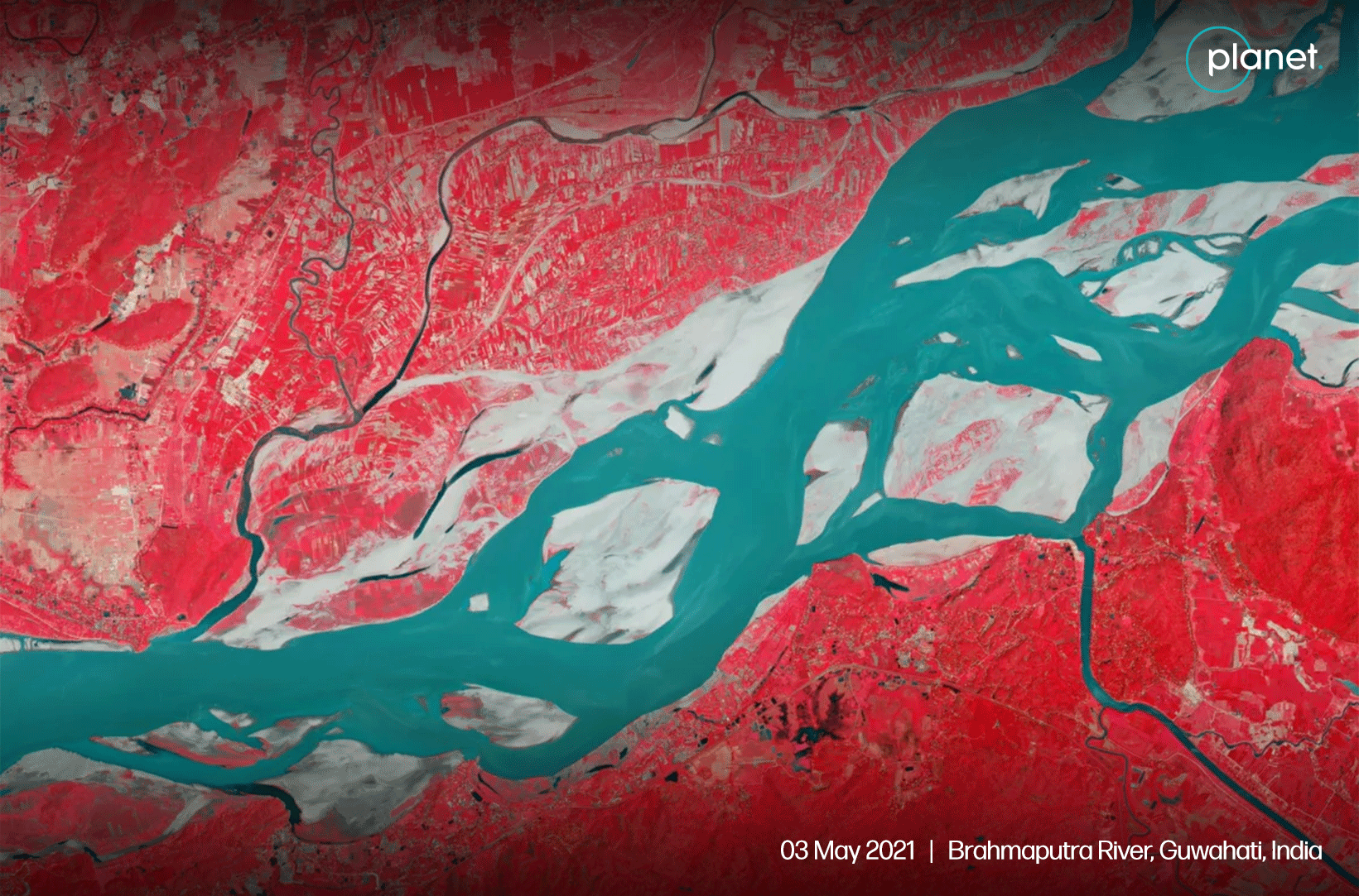
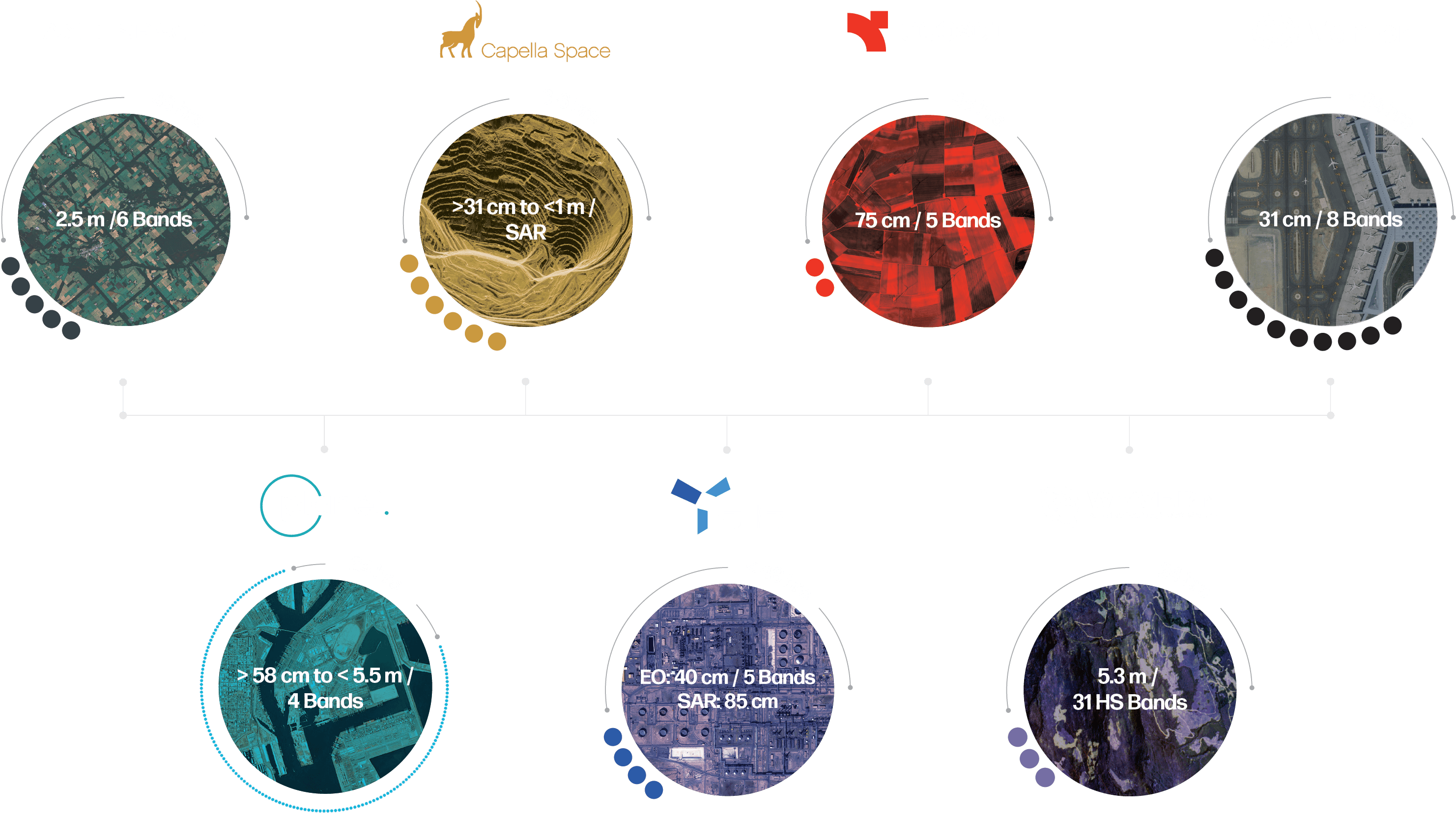
At its core, AstraView aggregates imagery from a network of more than 250 satellites, covering multispectral, SAR, and hyperspectral data. This is enabled through strategic partnerships with established providers including Vantor (formerly Maxar), Planet, Capella Space, Wyvern, Geosat, and others.
The real significance of this scale is not in the aggregate number alone but in how it transforms the available decision logic. In a single-constellation environment, collection strategies are inherently constrained by that constellation's orbital parameters, revisit cadence, vulnerability to weather, and sensor-specific limitations.
Through AstraView's multi-constellation framework, the focus shifts from "What can this one provider deliver?" to "Which combination of assets most effectively addresses the specific requirement?", accounting for cost, resolution, revisit, environmental conditions, and analytical needs.
AstraView’s multi-constellation structure also increases collection efficiency. The platform selects the asset mix with the highest probability of successful capture at the requested minute, accounting for cloud forecasts and orbital geometry, without exposure to vendor-side priority shifts.
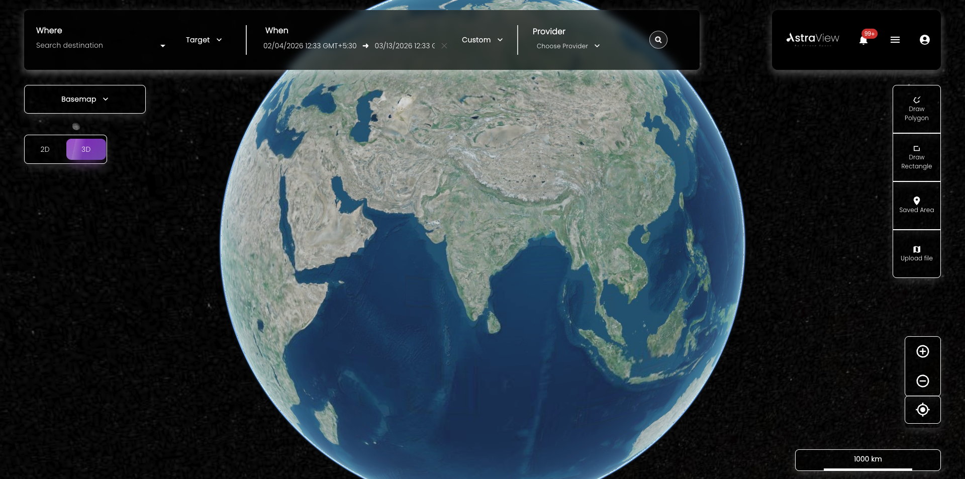
Plan Before You Task

Direct tasking is available to end users, but the process is designed to avoid blind submissions. Feasibility checks, footprint previews, and collection geometry evaluations are integrated directly into the workflow, enabling users to assess coverage quality, viewing angles, and overall viability before any commitment is made.
Weather forecasting is embedded via a dedicated API, which allows optical tasking decisions to incorporate predicted cloud cover and other conditions during the planning stage rather than discovering issues after acquisition. As a result, avoidable re-tasking cycles are minimized, and overall operational timelines are compressed.
Archive search extends across the aggregated network, providing visibility into historical data from multiple constellations rather than requiring separate queries across vendor silos. This capability makes it far simpler to construct robust temporal baselines and perform change-detection analyses without vendor-specific limitations.
Together, these elements move users from reactive, ad-hoc ordering to deliberate, upfront collection design.
Simplified Execution
AstraView removes much of the traditional operational overhead associated with satellite imagery access.
There is no requirement for users to own or manage satellites, coordinate constellations, operate ground segments, or navigate asset-level regulatory licensing. Capacity is made available without the corresponding infrastructure responsibilities.
Contracts across multiple providers are consolidated into structured, regulation-compliant solutions tailored to the end user's specific needs, which reduces fragmentation in procurement and simplifies compliance and auditing processes, which is particularly valuable for government and security-sensitive deployments.
Security is architected at the platform level, with support for both on-premise deployments and secure cloud environments, role-based access controls, signed URLs, and robust session management. Organizations can therefore align data access and handling with their internal governance models rather than adapting those models to individual vendor requirements.
Multi-Modal, One Interface
Instead of treating modalities in isolation, AstraView integrates multispectral, SAR, and hyperspectral, within a single, cohesive operational environment. This integration is essential because real-world questions in areas such as defence, agriculture, maritime, and infrastructure monitoring are rarely solvable with one sensor type alone.
An agricultural analysis might combine high-resolution optical data for vegetation health indices with hyperspectral measurements for early detection of material stress. Maritime domain awareness could leverage SAR for persistent monitoring through adverse weather alongside RF for detecting active signals. Infrastructure monitoring may alternate between optical visual assessments and SAR-derived deformation tracking, depending on conditions.
With modalities coexisting natively in the interface, users can filter and compare simultaneously by resolution, revisit frequency, cost, sensor characteristics, and other parameters. This supports strategic selection and combination rather than sequential procurement from different sources.
Complete & Coherent Control
While aggregation of suppliers is increasingly common across platforms, genuine coherence in control is far less so.
The distinction arises from integration depth: when archive discovery, fresh tasking, feasibility validation, embedded weather modeling, multi-modal selection, compliance consolidation, and enterprise-grade security are all contained within one unified environment, the user's cognitive load and operational friction decrease significantly.
The central question for the user becomes clearer and more focused i.e. What do we need to observe, at what resolution, with what revisit cadence, and under what environmental conditions?, and is no longer dominated by: Which vendor should we contact first?
AstraView’s does not expand the overall satellite imagery data supply. It reorganizes how that supply is discovered, evaluated, accessed, and deployed.
Why this matters
In a maturing imagery market, sustained advantage no longer derives from access to a single constellation. It derives from intelligent, flexible design across multiple constellations and modalities. When archive depth, on-demand tasking, multi-sensor orchestration, regulatory compliance, and security controls are integrated within a single access layer, decision-making becomes proactive and structured rather than reactive. This is the AstraView advantage.
About the Author:
Adithya Juvvadi
Adithya Juvvadi is the Product Manager for AstraView and ISOCS at Dhruva Space, where he leads the strategy and development of AstraView, the company’s Geospatial intelligence platform, working with customers and partners to deliver satellite imagery of various resolutions. Adithya also oversees the development and deployment of ISOCS, Dhruva Space’s ground segment software framework that supports mission operations and powers its Ground Station as a Service (GSaaS) offerings.